Donahue/Fish Barn (4)

photo credit: June Pedretti
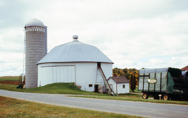
A local banker, Matt Donahue, who leased and rented to several Vernon County familes, owned the 66 foot diameter working barn for many years. The barn was built in 1910, apparently by the Tunks brothers and Ed Schenek. The ground level of the barn was built for livestock and the upper drive-in level for hay storage with a hay track along the outside wall. This track was used when the hay was put up loose. The 40 foot high, 12 foot diameter center silo was constructed using double wooden staves. The outside staves run horizontally, the inside staves run vertically. The two-pitch gambrel roof was done with wooden shingles. In the early 1940's, the original roof blew off during a storm and was replaced. The lower level originally had 39 stanchions on the outside wall facing inward toward the center silo. On the other side of the barn were box stalls for horses.
The John Fish family has owned the farm for over 30 years and operated it as a working dairy. During their owernership, they added metal siding, a metal roof and have done other basic maintenance to the round barn. In 1975, a long rectangular barn designed by Mr. Fish was added; the cows are now milked in this barn. Today, the hay is put up in small square bales and the center silo is used for high moisture ground ear corn.

Back to the main tour page or continue the tour:
- 6. Mt. Tabor (west) – From the north: Cty.F to Harris Rd. From the south: Hwy.33 to Harris Rd. West side of the road.
- 7. Mt. Tabor (north) – From Cty.F north on Cty. V. East side of the road.
- 8. Mt. Tabor (south) – From Cty.F south on Cty. V. East side of the road.
- 9. Trippville – Cty.F to Dank Rd. At the end of Dank Rd.
- 1. Viroqua –Hwy.56 east to Defreese St./Upper Maple Dale Rd.
North side of the road.
- 2. Bloomingdale – Cty.S to Pa’s Rd. South side of road.
- 3. Dell – Cty.P just east of Dell. North side of the road.

 MENU
MENU